Ops Evidence Pack
Dynamica field sensors, agromet context and irrigation decision support give farmers and agronomists operational value while feeding the evidence trail.
Agriculture, forestry and conservation d-MRV
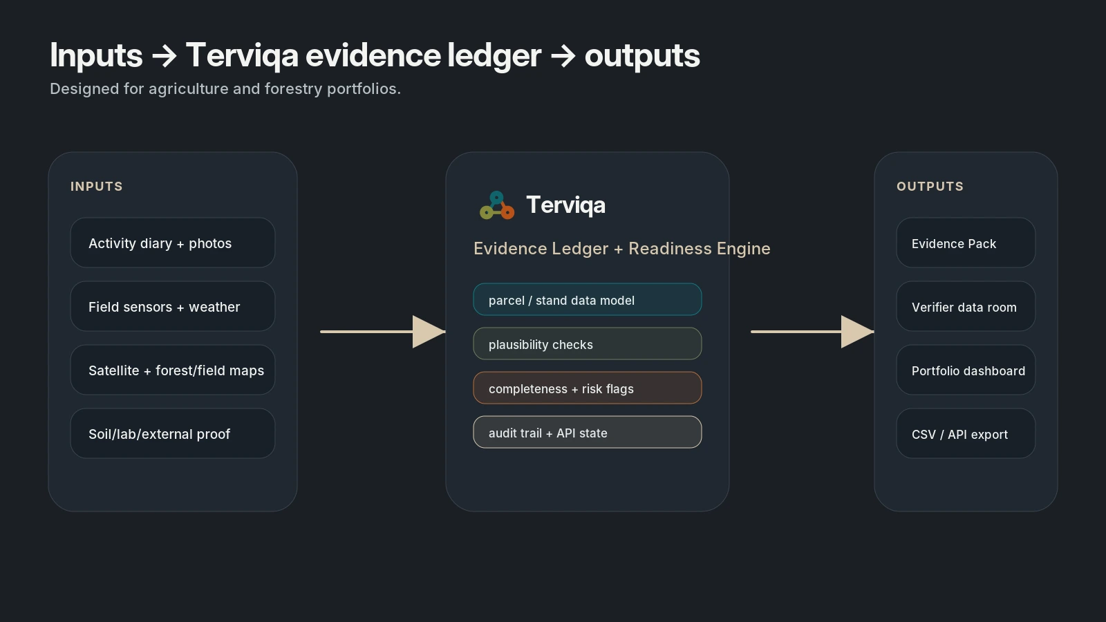
Terviqa turns operational land data into certification-support evidence packs.
We connect farmer and land-manager activity, georeferenced photos, field sensors, satellite analytics, biodiversity signals and external proof into one evidence ledger for cooperatives, agronomists, supply chains and MRV programmes.
Dynamica field sensors, agromet context and irrigation decision support give farmers and agronomists operational value while feeding the evidence trail.
VerdeSat screening-grade satellite indicators cover vegetation trends, habitat, fragmentation and biodiversity proxy metrics for farms, forests and conservation sites.
by Terviqa
A certification-support layer that checks completeness, flags gaps and prepares external-review evidence without claiming to issue credits.
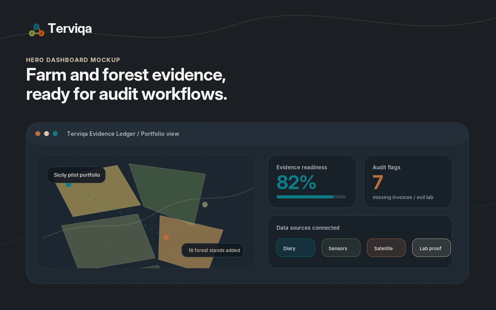
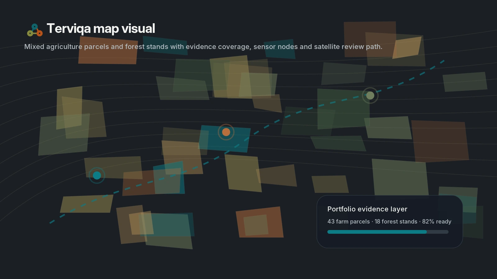
Portfolio coverage
Portfolio context matters before evidence becomes exportable. Terviqa organizes parcel coverage, sensor signals and satellite review paths in one view.
Why it exists
Farm software, satellite tools, sensors, carbon programmes and consultant reports often sit in separate silos. Terviqa packages the missing middle: a structured evidence workflow that makes land actions reviewable.
Capture field, forestry and conservation activity logs with photos and timestamps.
Cross-check actions against sensors, agromet data, satellite time series and external proof.
Score evidence completeness and surface missing items before buyer, programme or verifier review.
Export an Evidence Pack, methodology checklist, portfolio dashboard or API-ready data set.
Early traction
The first stack brings together Dynamica field-sensor and agromet data, VerdeSat screening-grade biodiversity indicators and Mioagronomo activity records, then adds Terviqa's evidence ledger and readiness workflow on top.
40
Dynamica field-sensor references in South Italy
4
VerdeSat biodiversity screening tests across pilot AOIs
5
beta pilots targeted for full Evidence Pack validation