Multi-source before model claims
Activity logs, photos, sensors, satellite observations and external records are kept together so every output can be traced back to its evidence source.
Science
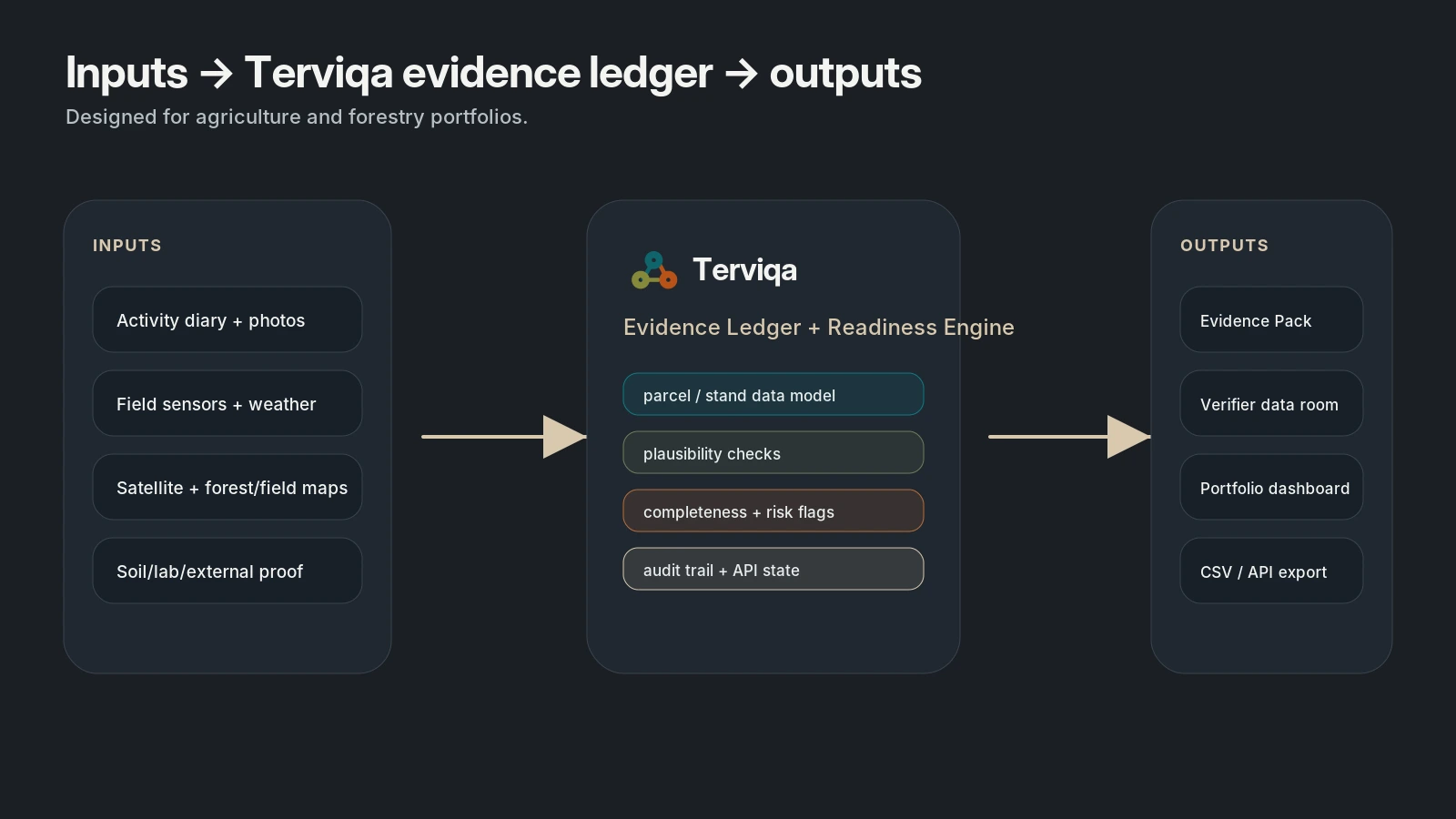
Terviqa's science layer is built around traceable evidence rather than a single black-box carbon number. The first product packages what can be credibly observed, checked and reviewed today.
Activity logs, photos, sensors, satellite observations and external records are kept together so every output can be traced back to its evidence source.
Terviqa separates estimates, completeness checks and certification-support evidence from verified credits or official claims.
Evidence quality, sensor coverage, satellite confidence and missing proof are surfaced as flags instead of hidden behind false precision.
Observable signals
Metrics are delivered as AOI-level tables, API/CSV time series and raster chips when needed. They are designed to support reporting, project tracking, habitat planning and compliance review across agricultural and forestry contexts.
Carbon roadmap
The near-term carbon layer focuses on activity-based CO2e estimates, evidence completeness and methodology-readiness checks. Flux-informed CO2 indicators using EO, weather, FLUXNET Shuttle, ICOS or European flux data and partner field towers are staged as a premium carbon-intelligence layer once validation data is strong enough.