Activity diary
Activity records, land-management actions, georeferenced photos, agronomist notes and activity-based CO2e estimates.
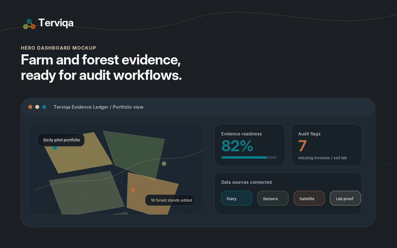
Platform
Terviqa is a multi-source d-MRV workspace for agriculture, forestry, conservation and restoration projects. It turns partner data and project evidence into reviewable records, readiness scores and exportable evidence packs.
Role boundary
Terviqa prepares certification-support evidence and audit trails. It is not a credit issuer, registry, certification body or external verifier.
Activity records, land-management actions, georeferenced photos, agronomist notes and activity-based CO2e estimates.
Sensors, agromet data, irrigation decision support, water-use context and sensor quality metadata.
Screening-grade vegetation time series, habitat indicators, fragmentation, land-cover change and biodiversity proxy metrics.
Labs and reviewers
Soil samples, invoices, field photos, chain-of-custody records, buyer requirements and external methodology checklists.
Outputs
The platform is designed for organisations managing many parcels or sites: cooperatives, agronomy consultants, supply chains, carbon programmes and forestry or conservation project teams.